 Sea Patris
Current Status
Where is the vessel?
Sea Patris is currently in Near PERAMA, based on AIS data received about 14h ago.
Latest AIS update:
Current position: 37.95823° N, 23.56178° E (Near PERAMA)
Average speed (last 7 days): Loading…
Average speed (last 30 days): Loading…
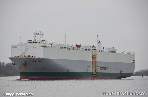
Vessel profile: Sea Patris is a Vehicles Carrier with dimensions 176m x 30m.
This page combines live AIS, route history, probable destination signals, nearby traffic, and port activity for practical vessel monitoring.
The current position of vessel Sea Patris is 37.95823 lat / 23.56178 lng. Updated: 2026-05-21 13:51:33 UTCNearest reference points:
- Near PERAMA
- Near Keratsínion
- Near Drapetzona
Currently sailing under the flag of Panama ![]()
Sea Patris built in 1985 year
Deadweight:
13895 tDetails:
Live Vessel Sea Patris Analytics (details, animations, etc.)
Recent AIS points (UTC):
2026-05-21 10:48:15 UTC · 37.95835, 23.56182 · SOG 0 kn · COG 187°2026-05-21 11:24:37 UTC · 37.95832, 23.56178 · SOG 0 kn · COG 187°
2026-05-21 13:06:30 UTC · 37.95833, 23.56187 · SOG 0 kn · COG 187°
2026-05-21 13:51:33 UTC · 37.95823, 23.56178 · SOG 0 kn · COG 187°