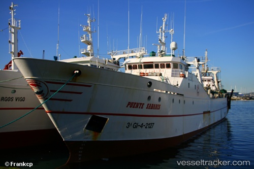
 PUENTE SABARIS
Current Status
Where is the vessel?
PUENTE SABARIS is currently in 91 nm SW of Koiingnaas, based on AIS data received about 15h ago.
Latest AIS update:
Current position: 31.25333° S, 16.00500° E (91 nm SW of Koiingnaas)
Average speed (last 7 days): Loading…
Average speed (last 30 days): Loading…
Vessel profile: PUENTE SABARIS is a Fishing Vessel with dimensions 11m x 70m.
This page combines live AIS, route history, probable destination signals, nearby traffic, and port activity for practical vessel monitoring.
The current position of vessel PUENTE SABARIS is -31.25333 lat / 16.00500 lng. Updated: 2026-05-21 09:45:19 UTCNearest reference points:
- 167 nm SW of Koiingnaas
- 154 nm W of Koiingnaas
- 161 nm W of Koiingnaas
Currently sailing under the flag of South Africa ![]()
PUENTE SABARIS built in 1986 year
Deadweight:
1216 tDetails:
Live Vessel PUENTE SABARIS Analytics (details, animations, etc.)
Recent AIS points (UTC):
2026-05-21 05:56:16 UTC · -31.09927, 15.79294 · SOG 5.4 kn · COG 135°2026-05-21 07:09:24 UTC · -31.15167, 15.85833 · SOG 3 kn · COG -1°
2026-05-21 07:42:22 UTC · -31.17333, 15.88833 · SOG 3 kn · COG -1°
2026-05-21 09:45:19 UTC · -31.25333, 16.00500 · SOG 3 kn · COG -1°