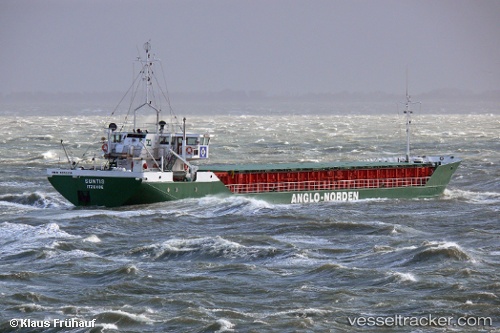
 Suntis
Current Status
Where is the vessel?
Suntis is currently in Near Eggstedt, based on AIS data received about 14h ago.
Latest AIS update:
Current position: 54.04650° N, 9.30522° E (Near Eggstedt)
Average speed (last 7 days): Loading…
Average speed (last 30 days): Loading…
Vessel profile: Suntis is a Multi Purpose Carrier with dimensions 82m x 11m.
This page combines live AIS, route history, probable destination signals, nearby traffic, and port activity for practical vessel monitoring.
The current position of vessel Suntis is 54.0465 lat / 9.30522 lng. Updated: 2026-05-20 01:07:29 UTCNearest reference points:
- Near Kiel Canal
- Near Abbenfleth
- Near Stader Sand
Currently sailing under the flag of Germany ![]()
Suntis built in 1985 year
Deadweight:
1815 tDetails:
Live Vessel Suntis Analytics (details, animations, etc.)
Recent AIS points (UTC):
2026-05-19 21:40:38 UTC · 54.30840, 9.71177 · SOG 7.1 kn · COG 194°2026-05-19 22:48:58 UTC · 54.21370, 9.58381 · SOG 6.6 kn · COG 230°
2026-05-19 23:59:17 UTC · 54.15630, 9.38279 · SOG 6.9 kn · COG 244°
2026-05-20 01:07:29 UTC · 54.04650, 9.30522 · SOG 7 kn · COG 189°