 TARGET
Current Status
Where is the vessel?
TARGET is currently in 41 nm SW of Chilmark, based on AIS data received about 14h ago.
Latest AIS update:
Current position: 40.73497° N, 71.16335° W (41 nm SW of Chilmark)
Average speed (last 7 days): Loading…
Average speed (last 30 days): Loading…
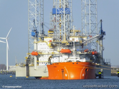
Vessel profile: TARGET is a Heavy Lift Vessel with dimensions m x m.
This page combines live AIS, route history, probable destination signals, nearby traffic, and port activity for practical vessel monitoring.
The current position of vessel TARGET is 40.73497 lat / -71.16335 lng. Updated: 2026-05-23 02:49:10 UTCNearest reference points:
- 37 nm NE of Offshore Ambrose
- Near JUDITH POINT
- 19 nm S of Chilmark
Currently sailing under the flag of Malta ![]()
Details:
Live Vessel TARGET Analytics (details, animations, etc.)
Recent AIS points (UTC):
2026-05-22 23:00:56 UTC · 40.91500, -71.20667 · SOG 0 kn · COG -1°2026-05-23 00:24:54 UTC · 40.83667, -71.18333 · SOG 7 kn · COG -1°
2026-05-23 01:27:56 UTC · 40.73916, -71.16069 · SOG 1.3 kn · COG 122°
2026-05-23 02:49:10 UTC · 40.73497, -71.16335 · SOG 0.3 kn · COG 160°