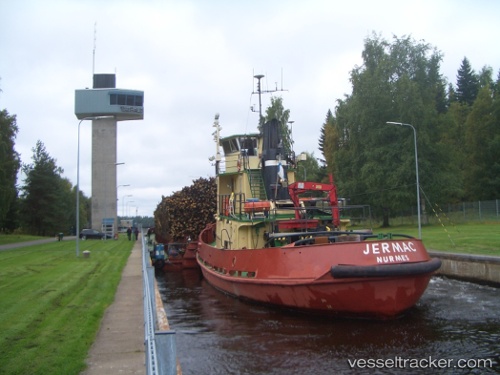
Jermac
Current StatusWhere is the vessel?
Jermac is currently in Near Asikkala, based on AIS data received about 14h ago.
Latest AIS update:
Current position: 62.02283° N, 28.64017° E (Near Asikkala)
Average speed (last 7 days): Loading…
Average speed (last 30 days): Loading…
Vessel profile: Jermac is a Pusher Tug with dimensions 12m x 81m.
This page combines live AIS, route history, probable destination signals, nearby traffic, and port activity for practical vessel monitoring.
The current position of vessel Jermac is 62.02283 lat / 28.64017 lng. Updated: 2026-05-19 04:29:28 UTCNearest reference points:
- Near Primorsk
- 10 nm SE of Primorsk
- 14 nm NW of KRONSHTADT
Details:
Live Vessel Jermac Analytics (details, animations, etc.)
Recent AIS points (UTC):
2026-05-19 01:30:58 UTC · 62.23260, 28.07492 · SOG 6.8 kn · COG 105°2026-05-19 01:35:58 UTC · 62.22977, 28.09446 · SOG 6.9 kn · COG 109°
2026-05-19 03:50:38 UTC · 62.07350, 28.52450 · SOG 6.7 kn · COG 134°
2026-05-19 04:29:28 UTC · 62.02283, 28.64017 · SOG 6.9 kn · COG 126°