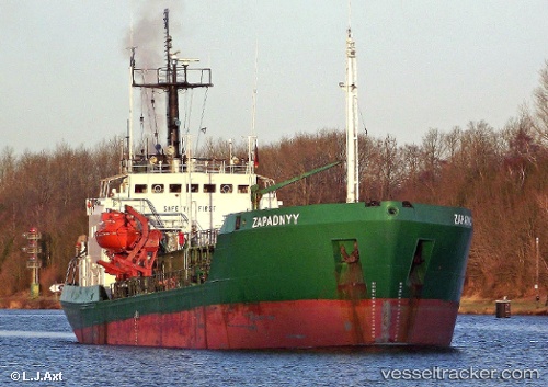
 ZAPADNYY
Current Status
Where is the vessel?
ZAPADNYY is currently in 13 nm NW of Holyhead, based on AIS data received about 14h ago.
Latest AIS update:
Current position: 53.40958° N, 4.96928° W (13 nm NW of Holyhead)
Average speed (last 7 days): Loading…
Average speed (last 30 days): Loading…
Vessel profile: ZAPADNYY is a Edible Oil Tanker with dimensions m x m.
This page combines live AIS, route history, probable destination signals, nearby traffic, and port activity for practical vessel monitoring.
The current position of vessel ZAPADNYY is 53.40958 lat / -4.96928 lng. Updated: 2026-05-21 19:58:00 UTCNearest reference points:
- Near Holyhead
- Near Douglas
- Near Skerries
Currently sailing under the flag of Comoros ![]()
Details:
Live Vessel ZAPADNYY Analytics (details, animations, etc.)
Recent AIS points (UTC):
2026-05-21 17:03:59 UTC · 53.77582, -4.60182 · SOG 6.7 kn · COG 192°2026-05-21 17:52:50 UTC · 53.68764, -4.68300 · SOG 8.5 kn · COG 206°
2026-05-21 19:49:10 UTC · 53.43071, -4.95031 · SOG 9.8 kn · COG 204°
2026-05-21 19:58:00 UTC · 53.40958, -4.96928 · SOG 9.7 kn · COG 204°