 vesseltracker.com
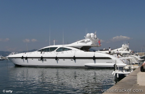
 PLAN A
Current Status
Where is the vessel?
PLAN A is currently in Near Monaco, based on AIS data received about 14h ago.
Latest AIS update:
Current position: 43.73677° N, 7.42739° E (Near Monaco)
Average speed (last 7 days): Loading…
Average speed (last 30 days): Loading…
Vessel profile: PLAN A is a Houseboat with dimensions 8m x 40m.
This page combines live AIS, route history, probable destination signals, nearby traffic, and port activity for practical vessel monitoring.
The current position of vessel PLAN A is 43.73677 lat / 7.42739 lng. Updated: 2026-05-18 11:56:09 UTCNearest reference points:
- Near Monaco
- Near Monte-Carlo
- Near SAINTJEAN CAP FERRAT
Currently sailing under the flag of Malta ![]()
PLAN A built in 2007 year
Deadweight:
0 tDetails:
Live Vessel PLAN A Analytics (details, animations, etc.)
Recent AIS points (UTC):
2026-05-18 07:51:10 UTC · 43.73684, 7.42729 · SOG 0 kn · COG 75°2026-05-18 09:47:08 UTC · 43.73681, 7.42738 · SOG 0.1 kn · COG 76°
2026-05-18 10:47:08 UTC · 43.73682, 7.42737 · SOG 0 kn · COG 74°
2026-05-18 11:56:09 UTC · 43.73677, 7.42739 · SOG 0 kn · COG 76°