 vesseltracker.com
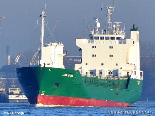
 LINK STAR
Current Status
Where is the vessel?
LINK STAR is currently in 25 nm NE of Cambs, based on AIS data received less than 1h ago.
Latest AIS update:
Current position: 55.50333° N, 1.82167° E (25 nm NE of Cambs)
Average speed (last 7 days): Loading…
Average speed (last 30 days): Loading…
Vessel profile: LINK STAR is a Ro-Ro Cargo Ship with dimensions 107m x 17m.
This page combines live AIS, route history, probable destination signals, nearby traffic, and port activity for practical vessel monitoring.
The current position of vessel LINK STAR is 55.50333 lat / 1.82167 lng. Updated: 2026-05-13 16:30:54 UTCNearest reference points:
- 26 nm W of Cleghorn
- 28 nm N of Weaverthorpe
- 19 nm W of Curlew
Currently sailing under the flag of Norway (NIS) ![]()
LINK STAR built in 1989 year
Deadweight:
4453 tDetails:
Live Vessel LINK STAR Analytics (details, animations, etc.)
Recent AIS points (UTC):
2026-05-13 13:21:54 UTC · 55.90833, 2.20667 · SOG 8 kn · COG -1°2026-05-13 14:18:57 UTC · 55.78500, 2.09167 · SOG 8 kn · COG -1°
2026-05-13 15:24:53 UTC · 55.64167, 1.95667 · SOG 8 kn · COG -1°
2026-05-13 16:30:54 UTC · 55.50333, 1.82167 · SOG 8 kn · COG -1°