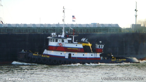
 THEO C
Current Status
Where is the vessel?
THEO C is currently in Near Bal Harbour, based on AIS data received about 15h ago.
Latest AIS update:
Current position: 25.88496° N, 80.04553° W (Near Bal Harbour)
Average speed (last 7 days): Loading…
Average speed (last 30 days): Loading…
Vessel profile: THEO C is a Tug with dimensions m x m.
This page combines live AIS, route history, probable destination signals, nearby traffic, and port activity for practical vessel monitoring.
The current position of vessel THEO C is 25.88496 lat / -80.04553 lng. Updated: 2026-05-20 07:30:34 UTCNearest reference points:
- Near North Bay Village
- Near SUNNY ISLES
- Near Biscayne Park
Currently sailing under the flag of United States ![]()
Details:
Live Vessel THEO C Analytics (details, animations, etc.)
Recent AIS points (UTC):
2026-05-20 04:40:45 UTC · 26.09266, -80.12010 · SOG 0 kn · COG -1°2026-05-20 05:56:14 UTC · 26.07627, -80.07874 · SOG 4 kn · COG -1°
2026-05-20 07:19:46 UTC · 25.90610, -80.04829 · SOG 7.3 kn · COG -1°
2026-05-20 07:30:34 UTC · 25.88496, -80.04553 · SOG 6.8 kn · COG -1°