 ANTARES
Current Status
Where is the vessel?
ANTARES is currently in 42 nm E of Matua island, based on AIS data received about 14h ago.
Latest AIS update:
Current position: 48.11500° N, 154.34500° E (42 nm E of Matua island)
Average speed (last 7 days): Loading…
Average speed (last 30 days): Loading…
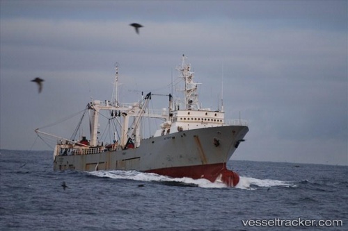
Vessel profile: ANTARES is a Fishing Vessel with dimensions 73.75m x 12.2m.
This page combines live AIS, route history, probable destination signals, nearby traffic, and port activity for practical vessel monitoring.
The current position of vessel ANTARES is 48.11500 lat / 154.34500 lng. Updated: 2026-05-22 03:57:37 UTCCurrently sailing under the flag of Russia ![]()
ANTARES built in 1990 year
Deadweight:
444 tDetails:
Live Vessel ANTARES Analytics (details, animations, etc.)
Recent AIS points (UTC):
2026-05-22 01:33:29 UTC · 48.16000, 154.51666 · SOG 4 kn · COG -1°2026-05-22 01:36:39 UTC · 48.16221, 154.52203 · SOG 3.4 kn · COG 63°
2026-05-22 03:53:44 UTC · 48.11333, 154.34833 · SOG 4 kn · COG -1°
2026-05-22 03:57:37 UTC · 48.11500, 154.34500 · SOG 4 kn · COG -1°