 NANTUCKET_EXPRESS
Current Status
Where is the vessel?
NANTUCKET_EXPRESS is currently in Near NEW BEDFORD, based on AIS data received about 14h ago.
Latest AIS update:
Current position: 41.63550° N, 70.91907° W (Near NEW BEDFORD)
Average speed (last 7 days): Loading…
Average speed (last 30 days): Loading…
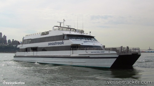
Vessel profile: NANTUCKET_EXPRESS is a Passengers Ship with dimensions m x m.
This page combines live AIS, route history, probable destination signals, nearby traffic, and port activity for practical vessel monitoring.
The current position of vessel NANTUCKET_EXPRESS is 41.63550 lat / -70.91907 lng. Updated: 2026-05-19 04:39:39 UTCNearest reference points:
- Near NEW BEDFORD
- Near FAIRHAVEN
- Near VINEYARD HAVEN
Currently sailing under the flag of United States ![]()
Details:
Live Vessel NANTUCKET_EXPRESS Analytics (details, animations, etc.)
Recent AIS points (UTC):
2026-05-19 01:54:29 UTC · 41.63554, -70.91909 · SOG 0 kn · COG 261°2026-05-19 02:18:38 UTC · 41.63553, -70.91914 · SOG 0 kn · COG 261°
2026-05-19 04:23:19 UTC · 41.63556, -70.91908 · SOG 0 kn · COG 263°
2026-05-19 04:39:39 UTC · 41.63550, -70.91907 · SOG 0 kn · COG 263°