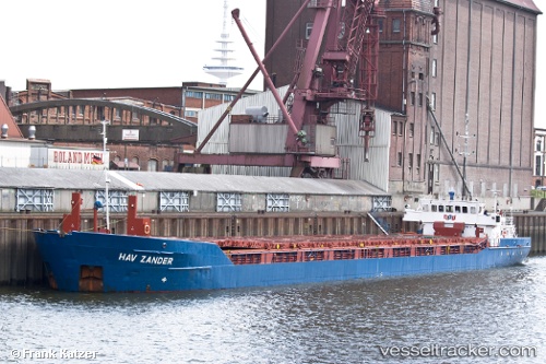
Hav Zander
Current StatusWhere is the vessel?
Hav Zander is currently in 21 nm N of ALDERNEY, based on AIS data received about 14h ago.
Latest AIS update:
Current position: 50.06233° N, 2.35083° W (21 nm N of ALDERNEY)
Average speed (last 7 days): Loading…
Average speed (last 30 days): Loading…
Vessel profile: Hav Zander is a Multi Purpose Carrier with dimensions 12m x 88m.
This page combines live AIS, route history, probable destination signals, nearby traffic, and port activity for practical vessel monitoring.
The current position of vessel Hav Zander is 50.06233 lat / -2.35083 lng. Updated: 2026-05-20 05:52:26 UTCNearest reference points:
- Near ALDERNEY
- Near Castletown
- 23 nm NW of Saint Sampson
Details:
Live Vessel Hav Zander Analytics (details, animations, etc.)
Recent AIS points (UTC):
2026-05-20 01:56:17 UTC · 50.21833, -1.49667 · SOG 7 kn · COG -1°2026-05-20 04:19:27 UTC · 50.11078, -2.02197 · SOG 9.8 kn · COG 251°
2026-05-20 04:36:17 UTC · 50.09918, -2.08840 · SOG 9.5 kn · COG 253°
2026-05-20 05:52:26 UTC · 50.06233, -2.35083 · SOG 7.1 kn · COG 257°