 vesseltracker.com
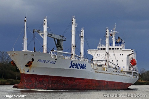
 PRINCE OF SEAS
Current Status
Where is the vessel?
PRINCE OF SEAS is currently in 26 nm SW of ARGUINEGUIN, based on AIS data received about 14h ago.
Latest AIS update:
Current position: 27.42391° N, 15.98018° W (26 nm SW of ARGUINEGUIN)
Average speed (last 7 days): Loading…
Average speed (last 30 days): Loading…
Vessel profile: PRINCE OF SEAS is a Reefer with dimensions m x m.
This page combines live AIS, route history, probable destination signals, nearby traffic, and port activity for practical vessel monitoring.
The current position of vessel PRINCE OF SEAS is 27.42391 lat / -15.98018 lng. Updated: 2026-05-18 03:49:46 UTCNearest reference points:
- 33 nm SE of San Agustin
- 22 nm S of San Agustin
- Near San Nicolás
Currently sailing under the flag of Bahamas ![]()
Details:
Live Vessel PRINCE OF SEAS Analytics (details, animations, etc.)
Recent AIS points (UTC):
2026-05-17 22:43:20 UTC · 27.47452, -15.88896 · SOG 1.2 kn · COG 237°2026-05-18 01:29:28 UTC · 27.43992, -15.93783 · SOG 1.1 kn · COG 252°
2026-05-18 01:29:28 UTC · 27.43992, -15.93783 · SOG 1.1 kn · COG 252°
2026-05-18 03:49:46 UTC · 27.42391, -15.98018 · SOG 1.1 kn · COG 245°