 AL KAREEM ZAFER
Current Status
Where is the vessel?
AL KAREEM ZAFER is currently in 72 nm SE of Kárpathos, based on AIS data received about 15h ago.
Latest AIS update:
Current position: 34.52850° N, 28.08370° E (72 nm SE of Kárpathos)
Average speed (last 7 days): Loading…
Average speed (last 30 days): Loading…
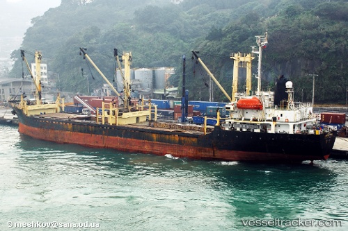
Vessel profile: AL KAREEM ZAFER is a General Cargo with dimensions m x m.
This page combines live AIS, route history, probable destination signals, nearby traffic, and port activity for practical vessel monitoring.
The current position of vessel AL KAREEM ZAFER is 34.52850 lat / 28.08370 lng. Updated: 2026-05-21 11:13:59 UTCNearest reference points:
- 91 nm SE of Polychnitos Lesvou
- 108 nm S of Kastellorizou (ex Megísti)
- 129 nm NW of ABU QIR
Currently sailing under the flag of Saint Kitts and Nevis ![]()
Details:
Live Vessel AL KAREEM ZAFER Analytics (details, animations, etc.)
Recent AIS points (UTC):
2026-05-21 08:09:01 UTC · 34.83979, 27.87896 · SOG 7 kn · COG 153°2026-05-21 08:45:51 UTC · 34.77333, 27.91333 · SOG 6 kn · COG -1°
2026-05-21 08:45:51 UTC · 34.77333, 27.91333 · SOG 6 kn · COG -1°
2026-05-21 11:13:59 UTC · 34.52850, 28.08370 · SOG 6.9 kn · COG 151°