 vesseltracker.com
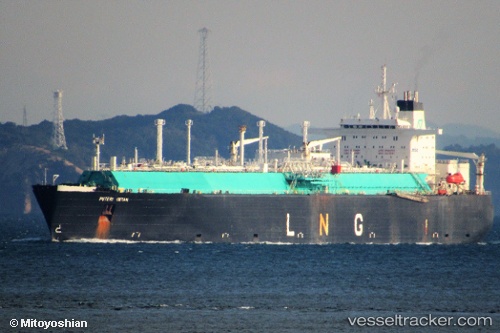
 AMERICAN ENERGY
Current Status
Where is the vessel?
AMERICAN ENERGY is currently in 24 nm SW of Cayman Brac, based on AIS data received about 15h ago.
Latest AIS update:
Current position: 19.35884° N, 80.11146° W (24 nm SW of Cayman Brac)
Average speed (last 7 days): Loading…
Average speed (last 30 days): Loading…
Vessel profile: AMERICAN ENERGY is a Lng Tanker with dimensions m x m.
This page combines live AIS, route history, probable destination signals, nearby traffic, and port activity for practical vessel monitoring.
The current position of vessel AMERICAN ENERGY is 19.35884 lat / -80.11146 lng. Updated: 2026-05-18 13:48:36 UTCNearest reference points:
- Near Georgetown, Grand Cayman
Currently sailing under the flag of United States ![]()
Details:
Live Vessel AMERICAN ENERGY Analytics (details, animations, etc.)
Recent AIS points (UTC):
2026-05-18 11:09:36 UTC · 19.24704, -79.58412 · SOG 11.9 kn · COG 282°2026-05-18 12:01:08 UTC · 19.28859, -79.75736 · SOG 11.9 kn · COG 283°
2026-05-18 13:23:46 UTC · 19.34569, -80.03027 · SOG 11.4 kn · COG 283°
2026-05-18 13:48:36 UTC · 19.35884, -80.11146 · SOG 11.3 kn · COG 284°