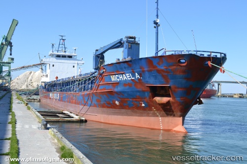
Michael A.
Current StatusWhere is the vessel?
Michael A. is currently in Near Mamonal, based on AIS data received about 14h ago.
Latest AIS update:
Current position: 10.33812° N, 75.51172° W (Near Mamonal)
Average speed (last 7 days): Loading…
Average speed (last 30 days): Loading…
Vessel profile: Michael A. is a Multi Purpose Carrier with dimensions 13m x 88m.
This page combines live AIS, route history, probable destination signals, nearby traffic, and port activity for practical vessel monitoring.
The current position of vessel Michael A. is 10.33812 lat / -75.51172 lng. Updated: 2026-05-21 14:01:38 UTCNearest reference points:
- Near Contecar
- Near Sociedad Portuaria Regional Cartagena
- Near Santa Marta
Details:
Live Vessel Michael A. Analytics (details, animations, etc.)
Recent AIS points (UTC):
2026-05-21 10:40:38 UTC · 10.33812, -75.51171 · SOG 0 kn · COG 178°2026-05-21 11:55:37 UTC · 10.33811, -75.51172 · SOG 0 kn · COG 179°
2026-05-21 13:37:38 UTC · 10.33812, -75.51171 · SOG 0 kn · COG 180°
2026-05-21 14:01:38 UTC · 10.33812, -75.51172 · SOG 0 kn · COG 177°