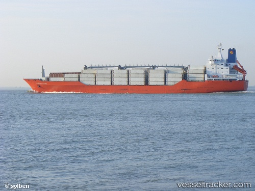
Charles Island
Current StatusWhere is the vessel?
Charles Island is currently in 290 nm NW of Upper Northfield, based on AIS data received about 15h ago.
Latest AIS update:
Current position: 25.11604° N, 48.15050° W (290 nm NW of Upper Northfield)
Average speed (last 7 days): Loading…
Average speed (last 30 days): Loading…
Vessel profile: Charles Island is a Refrigerated Cargo Ship with dimensions 25m x 180m.
This page combines live AIS, route history, probable destination signals, nearby traffic, and port activity for practical vessel monitoring.
The current position of vessel Charles Island is 25.11604 lat / -48.15050 lng. Updated: 2026-05-22 17:30:05 UTCNearest reference points:
- Open sea, approx. 401 nm off the nearest listed port
- Open sea, approx. 402 nm off the nearest listed port
- Open sea, approx. 403 nm off the nearest listed port
Details:
Live Vessel Charles Island Analytics (details, animations, etc.)
Recent AIS points (UTC):
2026-05-22 14:08:59 UTC · 25.72616, -47.25150 · SOG 18.2 kn · COG 232°2026-05-22 16:05:35 UTC · 25.36902, -47.77362 · SOG 18.3 kn · COG 234°
2026-05-22 16:05:35 UTC · 25.36902, -47.77362 · SOG 18.3 kn · COG 234°
2026-05-22 17:30:05 UTC · 25.11604, -48.15050 · SOG 17.7 kn · COG 234°