 ROYAL O
Current Status
Where is the vessel?
ROYAL O is currently in 13 nm E of Mundra Port SEZ, based on AIS data received about 14h ago.
Latest AIS update:
Current position: 22.79787° N, 69.96739° E (13 nm E of Mundra Port SEZ)
Average speed (last 7 days): Loading…
Average speed (last 30 days): Loading…
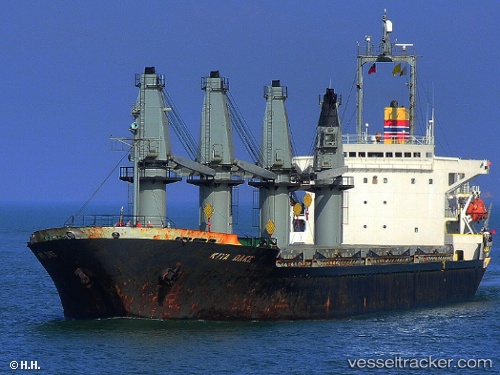
Vessel profile: ROYAL O is a Bulk Carrier with dimensions m x m.
This page combines live AIS, route history, probable destination signals, nearby traffic, and port activity for practical vessel monitoring.
The current position of vessel ROYAL O is 22.79787 lat / 69.96739 lng. Updated: 2026-05-18 22:01:30 UTCNearest reference points:
- 12 nm N of Rozi
- 15 nm N of Rozi
- Near Rozi
Currently sailing under the flag of Saint Kitts and Nevis ![]()
Details:
Live Vessel ROYAL O Analytics (details, animations, etc.)
Recent AIS points (UTC):
2026-05-18 19:40:01 UTC · 22.79798, 69.96731 · SOG 0.3 kn · COG 237°2026-05-18 20:10:56 UTC · 22.79792, 69.96737 · SOG 0 kn · COG 245°
2026-05-18 21:46:57 UTC · 22.79786, 69.96735 · SOG 0 kn · COG 241°
2026-05-18 22:01:30 UTC · 22.79787, 69.96739 · SOG 0 kn · COG -1°