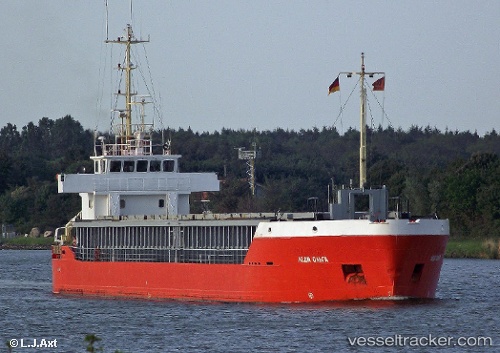
 SEA BARON
Current Status
Where is the vessel?
SEA BARON is currently in 22 nm W of Komiza, based on AIS data received about 14h ago.
Latest AIS update:
Current position: 42.92760° N, 15.60856° E (22 nm W of Komiza)
Average speed (last 7 days): Loading…
Average speed (last 30 days): Loading…
Vessel profile: SEA BARON is a General Cargo with dimensions m x m.
This page combines live AIS, route history, probable destination signals, nearby traffic, and port activity for practical vessel monitoring.
The current position of vessel SEA BARON is 42.92760 lat / 15.60856 lng. Updated: 2026-05-19 17:26:37 UTCNearest reference points:
- 26 nm N of Isole Tremiti
- Near Podglavica
- Near Rogoznica
Currently sailing under the flag of Panama ![]()
Details:
Live Vessel SEA BARON Analytics (details, animations, etc.)
Recent AIS points (UTC):
2026-05-19 13:36:17 UTC · 42.70530, 16.31189 · SOG 8.3 kn · COG 298°2026-05-19 15:58:27 UTC · 42.83767, 15.88574 · SOG 8.8 kn · COG 297°
2026-05-19 16:19:47 UTC · 42.85781, 15.81931 · SOG 9.1 kn · COG 298°
2026-05-19 17:26:37 UTC · 42.92760, 15.60856 · SOG 9 kn · COG 300°