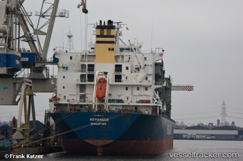
 HOYANGER
Current Status
Where is the vessel?
HOYANGER is currently in 108 nm NE of Lü-hua Shan, based on AIS data received about 15h ago.
Latest AIS update:
Current position: 31.55057° N, 124.52810° E (108 nm NE of Lü-hua Shan)
Average speed (last 7 days): Loading…
Average speed (last 30 days): Loading…
Vessel profile: HOYANGER is a General Cargo Ship with dimensions 31m x 213m.
This page combines live AIS, route history, probable destination signals, nearby traffic, and port activity for practical vessel monitoring.
The current position of vessel HOYANGER is 31.55057 lat / 124.52810 lng. Updated: 2026-05-20 02:32:31 UTCNearest reference points:
- 116 nm E of Lü-hua Shan
- 97 nm E of Lü-hua Shan
- 117 nm NE of Jingjiang
Currently sailing under the flag of Marshall Islands ![]()
HOYANGER built in 1995 year
Deadweight:
50198 tDetails:
Live Vessel HOYANGER Analytics (details, animations, etc.)
Recent AIS points (UTC):
2026-05-20 00:21:14 UTC · 31.75281, 124.97040 · SOG 13 kn · COG 241°2026-05-20 01:22:13 UTC · 31.65109, 124.74719 · SOG 11.6 kn · COG 243°
2026-05-20 01:47:13 UTC · 31.61781, 124.66133 · SOG 11.5 kn · COG 243°
2026-05-20 02:32:31 UTC · 31.55057, 124.52810 · SOG 7 kn · COG 230°