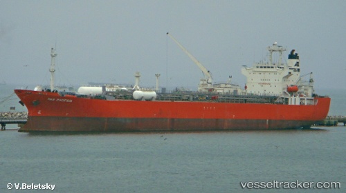
 GAS PACIFIC
Current Status
Where is the vessel?
GAS PACIFIC is currently in 23 nm SW of PORTOVAYA BERTH, based on AIS data received about 1d ago.
Latest AIS update:
Current position: 60.17336° N, 27.83504° E (23 nm SW of PORTOVAYA BERTH)
Average speed (last 7 days): Loading…
Average speed (last 30 days): Loading…
Vessel profile: GAS PACIFIC is a Lpg Tanker with dimensions m x m.
This page combines live AIS, route history, probable destination signals, nearby traffic, and port activity for practical vessel monitoring.
The current position of vessel GAS PACIFIC is 60.17336 lat / 27.83504 lng. Updated: 2026-05-20 18:59:31 UTCNearest reference points:
- 27 nm S of Klamila
- Near VISTINO
- Near Ruch’I
Currently sailing under the flag of Panama ![]()
Details:
Live Vessel GAS PACIFIC Analytics (details, animations, etc.)
Recent AIS points (UTC):
2026-05-20 18:59:31 UTC · 60.17336, 27.83504 · SOG 12.1 kn · COG 94°2026-05-20 18:59:31 UTC · 60.17336, 27.83504 · SOG 12.1 kn · COG 94°
2026-05-20 18:59:31 UTC · 60.17336, 27.83504 · SOG 12.1 kn · COG 94°
2026-05-20 18:59:31 UTC · 60.17336, 27.83504 · SOG 12.1 kn · COG 94°