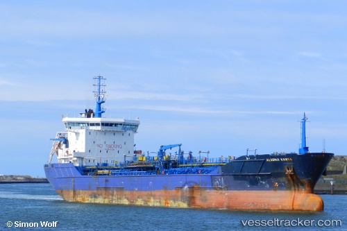
 MT ALGO
Current Status
Where is the vessel?
MT ALGO is currently in 10 nm W of Kwa Ibo, based on AIS data received about 14h ago.
Latest AIS update:
Current position: 4.42438° N, 7.84129° E (10 nm W of Kwa Ibo)
Average speed (last 7 days): Loading…
Average speed (last 30 days): Loading…
Vessel profile: MT ALGO is a Chemical Tanker with dimensions m x m.
This page combines live AIS, route history, probable destination signals, nearby traffic, and port activity for practical vessel monitoring.
The current position of vessel MT ALGO is 4.42438 lat / 7.84129 lng. Updated: 2026-05-21 14:03:41 UTCNearest reference points:
- Near Odudu Terminal
- Near Ima
- Near Bonny
Currently sailing under the flag of Liberia ![]()
Details:
Live Vessel MT ALGO Analytics (details, animations, etc.)
Recent AIS points (UTC):
2026-05-21 10:57:45 UTC · 4.42431, 7.84135 · SOG 0.1 kn · COG 219°2026-05-21 11:21:49 UTC · 4.42436, 7.84131 · SOG 0 kn · COG 213°
2026-05-21 13:26:44 UTC · 4.42430, 7.84135 · SOG 0 kn · COG 216°
2026-05-21 14:03:41 UTC · 4.42438, 7.84129 · SOG 0 kn · COG 207°