 ALYA
ALYA
Current Status
Where is the vessel?
ALYA is currently in 37 nm N of San Juan Bautista, based on AIS data received about 14h ago.
Latest AIS update:
Current position: 39.67303° N, 1.27453° E (37 nm N of San Juan Bautista)
Average speed (last 7 days): Loading…
Average speed (last 30 days): Loading…
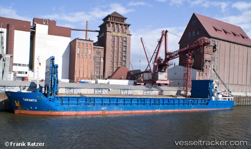
Vessel profile: ALYA is a General Cargo Ship with dimensions 88m x 11m.
This page combines live AIS, route history, probable destination signals, nearby traffic, and port activity for practical vessel monitoring.
The current position of vessel ALYA is 39.67303 lat / 1.27453 lng. Updated: 2026-05-22 11:41:45 UTCNearest reference points:
- 43 nm SE of PENISCOLA
- 18 nm NW of Sant Antoni de Portmany
- Near SANT ANTONI
Currently sailing under the flag of Panama ![]()
ALYA built in 1995 year
Deadweight:
3005 tDetails:
Live Vessel ALYA Analytics (details, animations, etc.)
Recent AIS points (UTC):
2026-05-22 08:14:46 UTC · 40.11552, 1.68307 · SOG 9.5 kn · COG 215°2026-05-22 09:24:54 UTC · 39.96622, 1.54281 · SOG 9.6 kn · COG 214°
2026-05-22 10:05:17 UTC · 39.88029, 1.46178 · SOG 9.4 kn · COG 215°
2026-05-22 11:41:45 UTC · 39.67303, 1.27453 · SOG 9.3 kn · COG 214°