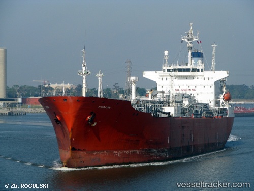
 TANIA STAR
Current Status
Where is the vessel?
TANIA STAR is currently in Near Sharjah, based on AIS data received about 34d ago.
Latest AIS update:
Current position: 25.49195° N, 55.22555° E (Near Sharjah)
Average speed (last 7 days): Loading…
Average speed (last 30 days): Loading…
Vessel profile: TANIA STAR is a Lpg Tanker with dimensions m x m.
This page combines live AIS, route history, probable destination signals, nearby traffic, and port activity for practical vessel monitoring.
The current position of vessel TANIA STAR is 25.49195 lat / 55.22555 lng. Updated: 2026-04-18 09:28:39 UTCNearest reference points:
- Near Sharjah
- Near AJMAN
- Near Free Port
Currently sailing under the flag of Benin ![]()
Details:
Live Vessel TANIA STAR Analytics (details, animations, etc.)
Recent AIS points (UTC):
2026-04-18 08:25:09 UTC · 25.49188, 55.22550 · SOG 0 kn · COG 321°2026-04-18 09:28:39 UTC · 25.49195, 55.22555 · SOG 0 kn · COG -1°
2026-04-18 09:28:39 UTC · 25.49195, 55.22555 · SOG 0 kn · COG -1°
2026-04-18 09:28:39 UTC · 25.49195, 55.22555 · SOG 0 kn · COG -1°