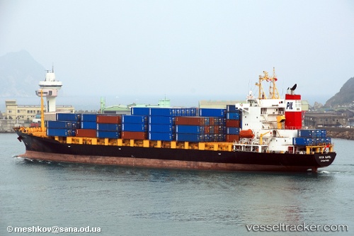
Salam Mewah
Current StatusWhere is the vessel?
Salam Mewah is currently in 87 nm NW of Abakaliki, based on AIS data received about 25d ago.
Latest AIS update:
Current position: 7.31965° N, 84.93891° E (87 nm NW of Abakaliki)
Average speed (last 7 days): Loading…
Average speed (last 30 days): Loading…
Vessel profile: Salam Mewah is a Container Ship with dimensions 25m x 158m.
This page combines live AIS, route history, probable destination signals, nearby traffic, and port activity for practical vessel monitoring.
The current position of vessel Salam Mewah is 7.31965 lat / 84.93891 lng. Updated: 2026-04-27 01:35:58 UTCNearest reference points:
- 46 nm SW of Abakaliki
- 23 nm S of Abakaliki
- 127 nm W of Abakaliki
Details:
Live Vessel Salam Mewah Analytics (details, animations, etc.)
Recent AIS points (UTC):
2026-04-27 01:35:58 UTC · 7.31965, 84.93891 · SOG 8.1 kn · COG 235°2026-04-27 01:35:58 UTC · 7.31965, 84.93891 · SOG 8.1 kn · COG 235°
2026-04-27 01:35:58 UTC · 7.31965, 84.93891 · SOG 8.1 kn · COG 235°
2026-04-27 01:35:58 UTC · 7.31965, 84.93891 · SOG 8.1 kn · COG 235°