 RUKIA
RUKIA
Current Status
Where is the vessel?
RUKIA is currently in Near Ablogamé, based on AIS data received about 14h ago.
Latest AIS update:
Current position: 6.04616° N, 1.32948° E (Near Ablogamé)
Average speed (last 7 days): Loading…
Average speed (last 30 days): Loading…
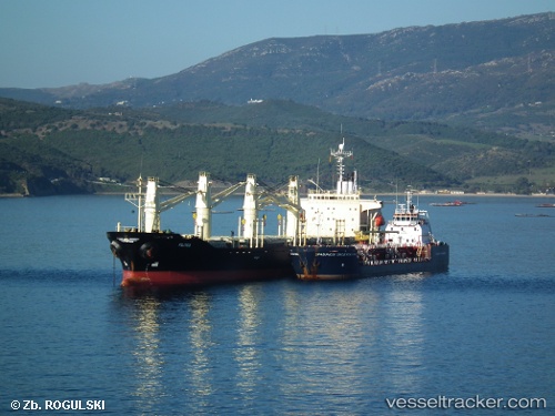
Vessel profile: RUKIA is a Bulk Carrier with dimensions 26m x 151m.
This page combines live AIS, route history, probable destination signals, nearby traffic, and port activity for practical vessel monitoring.
The current position of vessel RUKIA is 6.04616 lat / 1.32948 lng. Updated: 2026-05-21 09:18:54 UTCNearest reference points:
- Near Ablogamé
- Near Cotonou
- Near Kirikiri
Currently sailing under the flag of St.Kitts and Nevis ![]()
RUKIA built in 1996 year
Deadweight:
23709 tDetails:
Live Vessel RUKIA Analytics (details, animations, etc.)
Recent AIS points (UTC):
2026-05-21 05:48:54 UTC · 6.04643, 1.32923 · SOG 0.2 kn · COG 219°2026-05-21 06:48:53 UTC · 6.04625, 1.32941 · SOG 0.6 kn · COG 233°
2026-05-21 07:33:53 UTC · 6.04619, 1.32946 · SOG 0.4 kn · COG 228°
2026-05-21 09:18:54 UTC · 6.04616, 1.32948 · SOG 0.4 kn · COG 231°