 CARUZO
Current Status
Where is the vessel?
CARUZO is currently in 167 nm W of Tinaquillo, based on AIS data received about 14h ago.
Latest AIS update:
Current position: 10.55745° N, 65.54170° E (167 nm W of Tinaquillo)
Average speed (last 7 days): Loading…
Average speed (last 30 days): Loading…
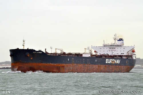
Vessel profile: CARUZO is a Crude Oil Tanker with dimensions m x m.
This page combines live AIS, route history, probable destination signals, nearby traffic, and port activity for practical vessel monitoring.
The current position of vessel CARUZO is 10.55745 lat / 65.54170 lng. Updated: 2026-05-19 01:51:26 UTCNearest reference points:
- 187 nm N of Tinaquillo
Currently sailing under the flag of Sierra Leone ![]()
Details:
Live Vessel CARUZO Analytics (details, animations, etc.)
Recent AIS points (UTC):
2026-05-18 22:06:26 UTC · 10.32167, 66.17500 · SOG 11 kn · COG -1°2026-05-18 23:48:28 UTC · 10.43167, 65.88500 · SOG 10 kn · COG -1°
2026-05-19 01:31:38 UTC · 10.53763, 65.59677 · SOG 10.5 kn · COG 288°
2026-05-19 01:51:26 UTC · 10.55745, 65.54170 · SOG 10.4 kn · COG 286°