 LUCKY LEO
Current Status
Where is the vessel?
LUCKY LEO is currently in 15 nm NE of Pepel, based on AIS data received about 15h ago.
Latest AIS update:
Current position: 8.72420° N, 12.85031° W (15 nm NE of Pepel)
Average speed (last 7 days): Loading…
Average speed (last 30 days): Loading…
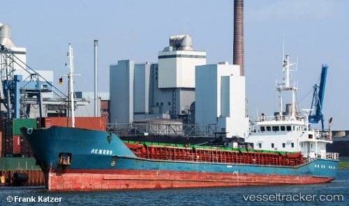
Vessel profile: LUCKY LEO is a General Cargo with dimensions m x m.
This page combines live AIS, route history, probable destination signals, nearby traffic, and port activity for practical vessel monitoring.
The current position of vessel LUCKY LEO is 8.72420 lat / -12.85031 lng. Updated: 2026-05-23 01:36:59 UTCNearest reference points:
- Near Kissy
- Near NASSIT
- 28 nm S of Conakry
Currently sailing under the flag of Palau ![]()
Details:
Live Vessel LUCKY LEO Analytics (details, animations, etc.)
Recent AIS points (UTC):
2026-05-22 22:34:08 UTC · 8.72422, -12.85030 · SOG 0 kn · COG 47°2026-05-22 23:45:29 UTC · 8.72420, -12.85034 · SOG 0 kn · COG 47°
2026-05-23 01:33:59 UTC · 8.72420, -12.85030 · SOG 0 kn · COG 47°
2026-05-23 01:36:59 UTC · 8.72420, -12.85031 · SOG 0 kn · COG 47°