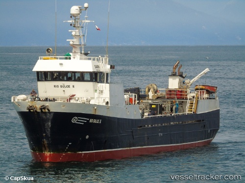
Rio Dulce Ii
Current StatusWhere is the vessel?
Rio Dulce Ii is currently in 15 nm NW of PUERTO CHACABUCO, based on AIS data received about 15h ago.
Latest AIS update:
Current position: 45.32071° S, 73.12638° W (15 nm NW of PUERTO CHACABUCO)
Average speed (last 7 days): Loading…
Average speed (last 30 days): Loading…
Vessel profile: Rio Dulce Ii is a Fish Carrier with dimensions 8m x 43m.
This page combines live AIS, route history, probable destination signals, nearby traffic, and port activity for practical vessel monitoring.
The current position of vessel Rio Dulce Ii is -45.32071 lat / -73.12638 lng. Updated: 2026-05-22 07:37:51 UTCNearest reference points:
- 68 nm W of Puerto Chacabuco
- Near Melinka
- Near Quellón (Puerto Quellón)
Details:
Live Vessel Rio Dulce Ii Analytics (details, animations, etc.)
Recent AIS points (UTC):
2026-05-22 04:38:53 UTC · -45.21602, -73.58123 · SOG 7.7 kn · COG -1°2026-05-22 06:04:40 UTC · -45.29574, -73.34896 · SOG 8.6 kn · COG -1°
2026-05-22 07:24:19 UTC · -45.30454, -73.15021 · SOG 6.2 kn · COG -1°
2026-05-22 07:37:51 UTC · -45.32071, -73.12638 · SOG 6.4 kn · COG -1°