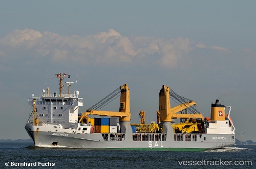
 ANNEMIEKE
Current Status
Where is the vessel?
ANNEMIEKE is currently in 42 nm N of Miramar, based on AIS data received about 16h ago.
Latest AIS update:
Current position: 23.80822° N, 82.57175° W (42 nm N of Miramar)
Average speed (last 7 days): Loading…
Average speed (last 30 days): Loading…
Vessel profile: ANNEMIEKE is a General Cargo with dimensions m x m.
This page combines live AIS, route history, probable destination signals, nearby traffic, and port activity for practical vessel monitoring.
The current position of vessel ANNEMIEKE is 23.80822 lat / -82.57175 lng. Updated: 2026-05-20 20:16:32 UTCNearest reference points:
- 40 nm S of Florida Straits
- Near ALAMEDA DEL SIBONEY
- Near Mariel
Currently sailing under the flag of Netherlands ![]()
Details:
Live Vessel ANNEMIEKE Analytics (details, animations, etc.)
Recent AIS points (UTC):
2026-05-20 16:25:15 UTC · 23.82552, -81.51114 · SOG 15.3 kn · COG 269°2026-05-20 16:25:15 UTC · 23.82552, -81.51114 · SOG 15.3 kn · COG 269°
2026-05-20 18:54:27 UTC · 23.80618, -82.19661 · SOG 15.1 kn · COG 269°
2026-05-20 20:16:32 UTC · 23.80822, -82.57175 · SOG 15.1 kn · COG 268°