 SAGA TUCANO
Current Status
Where is the vessel?
SAGA TUCANO is currently in 17 nm SW of Montevideo, based on AIS data received about 14h ago.
Latest AIS update:
Current position: 35.16709° S, 56.36248° W (17 nm SW of Montevideo)
Average speed (last 7 days): Loading…
Average speed (last 30 days): Loading…
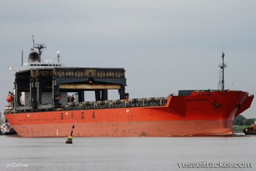
Vessel profile: SAGA TUCANO is a General Cargo with dimensions m x m.
This page combines live AIS, route history, probable destination signals, nearby traffic, and port activity for practical vessel monitoring.
The current position of vessel SAGA TUCANO is -35.16709 lat / -56.36248 lng. Updated: 2026-05-22 23:04:42 UTCNearest reference points:
- 16 nm N of Cabo San Antonio
- 12 nm S of Piriápolis
- Near JUAN LACAZE
Currently sailing under the flag of Bahamas ![]()
Details:
Live Vessel SAGA TUCANO Analytics (details, animations, etc.)
Recent AIS points (UTC):
2026-05-22 19:14:11 UTC · -34.99039, -57.21588 · SOG 11.9 kn · COG 138°2026-05-22 19:52:22 UTC · -35.07288, -57.12944 · SOG 12.5 kn · COG -1°
2026-05-22 21:27:23 UTC · -35.16774, -56.77535 · SOG 11.9 kn · COG 95°
2026-05-22 23:04:42 UTC · -35.16709, -56.36248 · SOG 12.6 kn · COG 98°