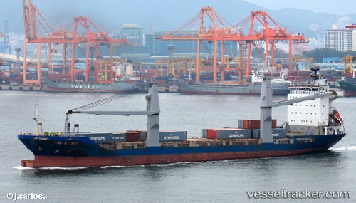
 OCEAN HUMILITY
Current Status
Where is the vessel?
OCEAN HUMILITY is currently in Near Bacong, based on AIS data received about 15h ago.
Latest AIS update:
Current position: 9.26872° N, 123.31041° E (Near Bacong)
Average speed (last 7 days): Loading…
Average speed (last 30 days): Loading…
Vessel profile: OCEAN HUMILITY is a Container Ship with dimensions m x m.
This page combines live AIS, route history, probable destination signals, nearby traffic, and port activity for practical vessel monitoring.
The current position of vessel OCEAN HUMILITY is 9.26872 lat / 123.31041 lng. Updated: 2026-05-22 20:04:43 UTCNearest reference points:
- 17 nm SW of Bacong
- Near TOLEDO
- Near Mandaue City
Currently sailing under the flag of Philippines ![]()
Details:
Live Vessel OCEAN HUMILITY Analytics (details, animations, etc.)
Recent AIS points (UTC):
2026-05-22 16:46:40 UTC · 9.26899, 123.30982 · SOG 0 kn · COG -1°2026-05-22 17:58:38 UTC · 9.26936, 123.30946 · SOG 0.1 kn · COG -1°
2026-05-22 19:52:41 UTC · 9.26874, 123.31028 · SOG 0 kn · COG -1°
2026-05-22 20:04:43 UTC · 9.26872, 123.31041 · SOG 0 kn · COG -1°