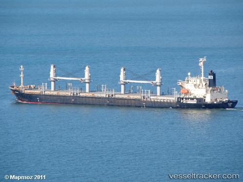
 AMIRAL
Current Status
Where is the vessel?
AMIRAL is currently in 17 nm NE of Lianyungang, based on AIS data received about 14h ago.
Latest AIS update:
Current position: 34.87465° N, 119.75587° E (17 nm NE of Lianyungang)
Average speed (last 7 days): Loading…
Average speed (last 30 days): Loading…
Vessel profile: AMIRAL is a General Cargo with dimensions m x m.
This page combines live AIS, route history, probable destination signals, nearby traffic, and port activity for practical vessel monitoring.
The current position of vessel AMIRAL is 34.87465 lat / 119.75587 lng. Updated: 2026-05-23 02:02:49 UTCNearest reference points:
- 18 nm E of Lianyungang
- Near Lianyungang
- 18 nm N of CHENJIAGANG
Currently sailing under the flag of Saint Kitts and Nevis ![]()
Details:
Live Vessel AMIRAL Analytics (details, animations, etc.)
Recent AIS points (UTC):
2026-05-22 21:56:21 UTC · 34.87616, 119.75569 · SOG 0 kn · COG 119°2026-05-22 23:53:50 UTC · 34.87543, 119.75554 · SOG 0 kn · COG 89°
2026-05-23 01:38:36 UTC · 34.87466, 119.75588 · SOG 0 kn · COG 63°
2026-05-23 02:02:49 UTC · 34.87465, 119.75587 · SOG 0 kn · COG 59°