 ATLAS COVE
Current Status
Where is the vessel?
ATLAS COVE is currently in 394 nm S of Al Azaiba, based on AIS data received about 14h ago.
Latest AIS update:
Current position: 30.02533° S, 60.03209° E (394 nm S of Al Azaiba)
Average speed (last 7 days): Loading…
Average speed (last 30 days): Loading…
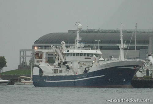
Vessel profile: ATLAS COVE is a Trawler with dimensions m x m.
This page combines live AIS, route history, probable destination signals, nearby traffic, and port activity for practical vessel monitoring.
The current position of vessel ATLAS COVE is -30.02533 lat / 60.03209 lng. Updated: 2026-05-20 23:20:51 UTCNearest reference points:
- Open sea, approx. 404 nm off the nearest listed port
- Open sea, approx. 406 nm off the nearest listed port
- Open sea (no nearby ports in database)
Currently sailing under the flag of Liberia ![]()
Details:
Live Vessel ATLAS COVE Analytics (details, animations, etc.)
Recent AIS points (UTC):
2026-05-20 17:56:29 UTC · -30.98318, 60.40343 · SOG 10.5 kn · COG 342°2026-05-20 21:38:12 UTC · -30.33280, 60.15736 · SOG 11.2 kn · COG 342°
2026-05-20 22:06:30 UTC · -30.24909, 60.12421 · SOG 11.2 kn · COG 344°
2026-05-20 23:20:51 UTC · -30.02533, 60.03209 · SOG 11.4 kn · COG 344°