 vesseltracker.com
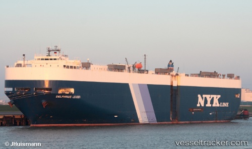
 DELPHINUS LEADER
Current Status
Where is the vessel?
DELPHINUS LEADER is currently in 109 nm NE of Pinelands, based on AIS data received about 14h ago.
Latest AIS update:
Current position: 34.93694° N, 20.33273° E (109 nm NE of Pinelands)
Average speed (last 7 days): Loading…
Average speed (last 30 days): Loading…
Vessel profile: DELPHINUS LEADER is a Vehicles Carrier with dimensions m x m.
This page combines live AIS, route history, probable destination signals, nearby traffic, and port activity for practical vessel monitoring.
The current position of vessel DELPHINUS LEADER is 34.93694 lat / 20.33273 lng. Updated: 2026-05-18 10:33:46 UTCNearest reference points:
- 61 nm N of Al Marj
- 85 nm W of Paleochora
- 71 nm N of Pinelands
Currently sailing under the flag of Liberia ![]()
Details:
Live Vessel DELPHINUS LEADER Analytics (details, animations, etc.)
Recent AIS points (UTC):
2026-05-18 07:13:48 UTC · 34.70037, 21.19409 · SOG 14.5 kn · COG 292°2026-05-18 07:49:36 UTC · 34.74805, 21.02956 · SOG 14.4 kn · COG 292°
2026-05-18 08:52:05 UTC · 34.82793, 20.74295 · SOG 14.5 kn · COG 290°
2026-05-18 10:33:46 UTC · 34.93694, 20.33273 · SOG 6.9 kn · COG 120°