 GREENSEA LUCENA
Current Status
Where is the vessel?
GREENSEA LUCENA is currently in 31 nm S of Maspalomas, based on AIS data received about 14h ago.
Latest AIS update:
Current position: 27.23983° N, 15.54428° W (31 nm S of Maspalomas)
Average speed (last 7 days): Loading…
Average speed (last 30 days): Loading…
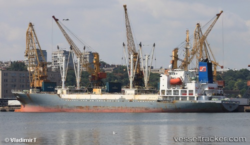
Vessel profile: GREENSEA LUCENA is a Reefer with dimensions m x m.
This page combines live AIS, route history, probable destination signals, nearby traffic, and port activity for practical vessel monitoring.
The current position of vessel GREENSEA LUCENA is 27.23983 lat / -15.54428 lng. Updated: 2026-05-22 23:48:59 UTCNearest reference points:
- 33 nm SE of San Agustin
- Near TALIARTE
- Near San Nicolás
Currently sailing under the flag of Bahamas ![]()
Details:
Live Vessel GREENSEA LUCENA Analytics (details, animations, etc.)
Recent AIS points (UTC):
2026-05-22 20:25:47 UTC · 27.84096, -15.24986 · SOG 16.7 kn · COG 179°2026-05-22 22:11:56 UTC · 27.37966, -15.42007 · SOG 16.5 kn · COG 199°
2026-05-22 22:34:47 UTC · 27.29205, -15.47810 · SOG 16.3 kn · COG 226°
2026-05-22 23:48:59 UTC · 27.23983, -15.54428 · SOG 2 kn · COG 299°