De Mei
Current StatusWhere is the vessel?
De Mei is currently in 19 nm NW of Pei-Hai, based on AIS data received about 15h ago.
Latest AIS update:
Current position: 20.75500° N, 108.86666° E (19 nm NW of Pei-Hai)
Average speed (last 7 days): Loading…
Average speed (last 30 days): Loading…
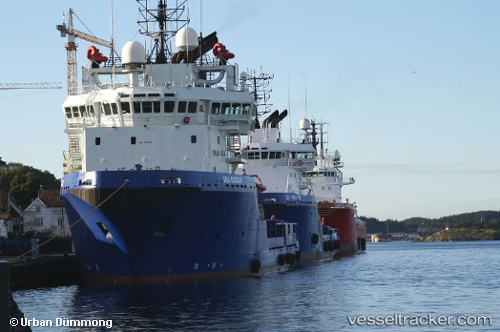
Vessel profile: De Mei is a Offshore Tug Supply Ship with dimensions 16m x 75m.
This page combines live AIS, route history, probable destination signals, nearby traffic, and port activity for practical vessel monitoring.
The current position of vessel De Mei is 20.75500 lat / 108.86666 lng. Updated: 2026-05-18 21:43:51 UTCNearest reference points:
- 36 nm NW of Pei-Hai
- Near Haikou New Pt
- 19 nm S of Beihai Pt
Details:
Live Vessel De Mei Analytics (details, animations, etc.)
Recent AIS points (UTC):
2026-05-18 19:49:10 UTC · 20.75603, 108.86685 · SOG 0.1 kn · COG 260°2026-05-18 19:49:10 UTC · 20.75603, 108.86685 · SOG 0.1 kn · COG 260°
2026-05-18 21:43:51 UTC · 20.75500, 108.86666 · SOG 0 kn · COG -1°
2026-05-18 21:43:51 UTC · 20.75500, 108.86666 · SOG 0 kn · COG -1°