 Tamesis
Current Status
Where is the vessel?
Tamesis is currently in Near DUNDALK, based on AIS data received about 14h ago.
Latest AIS update:
Current position: 39.24112° N, 76.53495° W (Near DUNDALK)
Average speed (last 7 days): Loading…
Average speed (last 30 days): Loading…
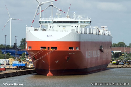
Vessel profile: Tamesis is a Vehicles Carrier with dimensions 244m x 32m.
This page combines live AIS, route history, probable destination signals, nearby traffic, and port activity for practical vessel monitoring.
The current position of vessel Tamesis is 39.24112 lat / -76.53495 lng. Updated: 2026-05-22 21:41:19 UTCNearest reference points:
- Near DUNDALK
- Near Baltimore
- Near Curtis Bay, Baltimore
Currently sailing under the flag of Norway ![]()
Tamesis built in 2000 year
Deadweight:
39516 tDetails:
Live Vessel Tamesis Analytics (details, animations, etc.)
Recent AIS points (UTC):
2026-05-22 18:17:20 UTC · 39.24111, -76.53495 · SOG 0 kn · COG 323°2026-05-22 19:35:16 UTC · 39.24110, -76.53494 · SOG 0 kn · COG 323°
2026-05-22 20:17:17 UTC · 39.24112, -76.53495 · SOG 0 kn · COG 323°
2026-05-22 21:41:19 UTC · 39.24112, -76.53495 · SOG 0 kn · COG 323°