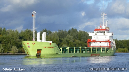
 MAI LEHMANN
Current Status
Where is the vessel?
MAI LEHMANN is currently in Near HUSUM, based on AIS data received about 14h ago.
Latest AIS update:
Current position: 54.47149° N, 9.03584° E (Near HUSUM)
Average speed (last 7 days): Loading…
Average speed (last 30 days): Loading…
Vessel profile: MAI LEHMANN is a General Cargo Ship with dimensions 8m x 5m.
This page combines live AIS, route history, probable destination signals, nearby traffic, and port activity for practical vessel monitoring.
The current position of vessel MAI LEHMANN is 54.47149 lat / 9.03584 lng. Updated: 2026-05-20 10:25:43 UTCNearest reference points:
- Near Flensburg
- Near Busdorf bei Schleswig
- Near Wees
Currently sailing under the flag of Antigua and Barbuda ![]()
MAI LEHMANN built in 1999 year
Deadweight:
4135 tDetails:
Live Vessel MAI LEHMANN Analytics (details, animations, etc.)
Recent AIS points (UTC):
2026-05-20 07:43:40 UTC · 54.47152, 9.03586 · SOG 0 kn · COG 166°2026-05-20 08:04:43 UTC · 54.47149, 9.03580 · SOG 0 kn · COG 166°
2026-05-20 09:40:48 UTC · 54.47150, 9.03585 · SOG 0 kn · COG 166°
2026-05-20 10:25:43 UTC · 54.47149, 9.03584 · SOG 0 kn · COG 166°