 AFAMIA STAR
Current Status
Where is the vessel?
AFAMIA STAR is currently in Near Arwad, based on AIS data received about 14h ago.
Latest AIS update:
Current position: 34.86126° N, 35.86493° E (Near Arwad)
Average speed (last 7 days): Loading…
Average speed (last 30 days): Loading…
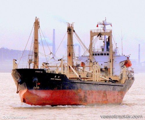
Vessel profile: AFAMIA STAR is a General Cargo with dimensions m x m.
This page combines live AIS, route history, probable destination signals, nearby traffic, and port activity for practical vessel monitoring.
The current position of vessel AFAMIA STAR is 34.86126 lat / 35.86493 lng. Updated: 2026-05-21 10:46:58 UTCNearest reference points:
- Near Tartous
- Near Tripoli
- Near Al Ladhiqiyah
Currently sailing under the flag of Comoros ![]()
Details:
Live Vessel AFAMIA STAR Analytics (details, animations, etc.)
Recent AIS points (UTC):
2026-05-21 07:16:57 UTC · 34.86107, 35.86510 · SOG 0 kn · COG 312°2026-05-21 08:10:57 UTC · 34.86114, 35.86505 · SOG 0.2 kn · COG 312°
2026-05-21 09:52:56 UTC · 34.86118, 35.86495 · SOG 0.3 kn · COG 312°
2026-05-21 10:46:58 UTC · 34.86126, 35.86493 · SOG 0.6 kn · COG 312°