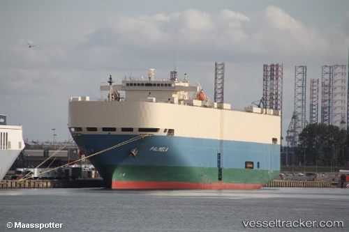
Palmela
Current StatusWhere is the vessel?
Palmela is currently in Near Port Blakely, based on AIS data received about 14h ago.
Latest AIS update:
Current position: 47.55713° N, 122.52567° W (Near Port Blakely)
Average speed (last 7 days): Loading…
Average speed (last 30 days): Loading…
Vessel profile: Palmela is a Vehicles Carrier with dimensions 32m x 199m.
This page combines live AIS, route history, probable destination signals, nearby traffic, and port activity for practical vessel monitoring.
The current position of vessel Palmela is 47.55713 lat / -122.52567 lng. Updated: 2026-05-19 00:05:20 UTCNearest reference points:
- Near BAINBRIDGE ISLAND
- Near Bremerton
- Near Port Madison
Details:
Live Vessel Palmela Analytics (details, animations, etc.)
Recent AIS points (UTC):
2026-05-18 19:44:19 UTC · 47.55716, -122.52545 · SOG 0 kn · COG 165°2026-05-18 21:44:18 UTC · 47.55643, -122.52658 · SOG 0.1 kn · COG 91°
2026-05-18 21:59:20 UTC · 47.55678, -122.52628 · SOG 0 kn · COG 114°
2026-05-19 00:05:20 UTC · 47.55713, -122.52567 · SOG 0.1 kn · COG 168°