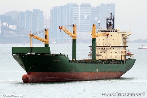
 MERATUS JAYAGIRI
Current Status
Where is the vessel?
MERATUS JAYAGIRI is currently in 19 nm SE of Phan Rang-Tháp Chàm, based on AIS data received about 14h ago.
Latest AIS update:
Current position: 11.27444° N, 109.11968° E (19 nm SE of Phan Rang-Tháp Chàm)
Average speed (last 7 days): Loading…
Average speed (last 30 days): Loading…
Vessel profile: MERATUS JAYAGIRI is a Container Ship with dimensions m x m.
This page combines live AIS, route history, probable destination signals, nearby traffic, and port activity for practical vessel monitoring.
The current position of vessel MERATUS JAYAGIRI is 11.27444 lat / 109.11968 lng. Updated: 2026-05-22 16:07:26 UTCNearest reference points:
- Near Vinh Cam Ranh
- Near Rang Dong
- 30 nm NW of Bach Ho
Currently sailing under the flag of Panama ![]()
Details:
Live Vessel MERATUS JAYAGIRI Analytics (details, animations, etc.)
Recent AIS points (UTC):
2026-05-22 13:03:15 UTC · 11.72486, 109.45056 · SOG 10.5 kn · COG 210°2026-05-22 13:53:56 UTC · 11.59853, 109.37275 · SOG 10.7 kn · COG 217°
2026-05-22 16:00:25 UTC · 11.29152, 109.13362 · SOG 11.2 kn · COG 217°
2026-05-22 16:07:26 UTC · 11.27444, 109.11968 · SOG 11.2 kn · COG 218°