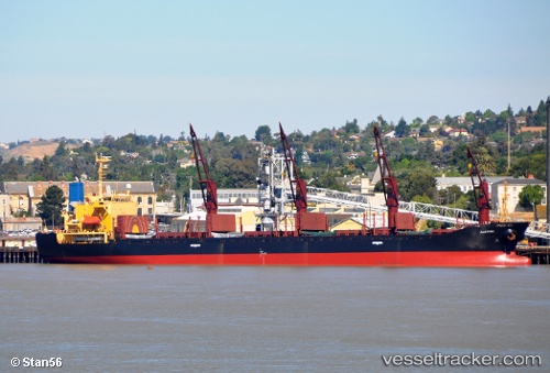
 AK HALIMA
Current Status
Where is the vessel?
AK HALIMA is currently in 17 nm S of Piriápolis, based on AIS data received about 14h ago.
Latest AIS update:
Current position: 35.15451° S, 55.26037° W (17 nm S of Piriápolis)
Average speed (last 7 days): Loading…
Average speed (last 30 days): Loading…
Vessel profile: AK HALIMA is a Bulk Carrier with dimensions m x m.
This page combines live AIS, route history, probable destination signals, nearby traffic, and port activity for practical vessel monitoring.
The current position of vessel AK HALIMA is -35.15451 lat / -55.26037 lng. Updated: 2026-05-19 23:26:56 UTCNearest reference points:
- 12 nm S of Piriápolis
- 21 nm E of PUNTA DEL ESTE
- 16 nm N of Cabo San Antonio
Currently sailing under the flag of Sierra Leone ![]()
Details:
Live Vessel AK HALIMA Analytics (details, animations, etc.)
Recent AIS points (UTC):
2026-05-19 19:56:57 UTC · -35.15375, -55.26025 · SOG 0.8 kn · COG 265°2026-05-19 21:47:59 UTC · -35.15405, -55.26025 · SOG 0.7 kn · COG 275°
2026-05-19 22:32:56 UTC · -35.15465, -55.26024 · SOG 0.1 kn · COG 276°
2026-05-19 23:26:56 UTC · -35.15451, -55.26037 · SOG 0.3 kn · COG 260°