 St. Mary
Current Status
Where is the vessel?
St. Mary is currently in 23 nm E of Kakap Natuna Terminal, based on AIS data received about 14h ago.
Latest AIS update:
Current position: 5.12333° N, 106.31167° E (23 nm E of Kakap Natuna Terminal)
Average speed (last 7 days): Loading…
Average speed (last 30 days): Loading…
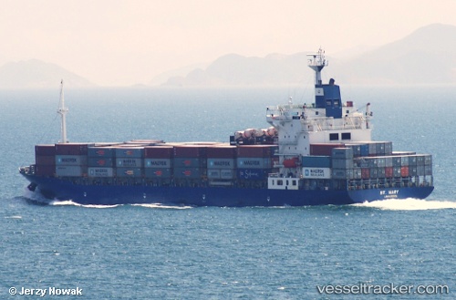
Vessel profile: St. Mary is a Container Ship with dimensions 168m x 27m.
This page combines live AIS, route history, probable destination signals, nearby traffic, and port activity for practical vessel monitoring.
The current position of vessel St. Mary is 5.12333 lat / 106.31167 lng. Updated: 2026-05-20 02:18:17 UTCNearest reference points:
- 45 nm E of Kakap Natuna Terminal
- 46 nm E of Kakap Natuna Terminal
- 36 nm SW of Slipi
Currently sailing under the flag of Cyprus ![]()
St. Mary built in 2001 year
Deadweight:
21579 tDetails:
Live Vessel St. Mary Analytics (details, animations, etc.)
Recent AIS points (UTC):
2026-05-19 23:03:13 UTC · 4.56167, 106.01333 · SOG 11 kn · COG -1°2026-05-20 00:06:16 UTC · 4.72667, 106.13500 · SOG 11 kn · COG -1°
2026-05-20 02:06:14 UTC · 5.08333, 106.30333 · SOG 12 kn · COG -1°
2026-05-20 02:18:17 UTC · 5.12333, 106.31167 · SOG 12 kn · COG -1°