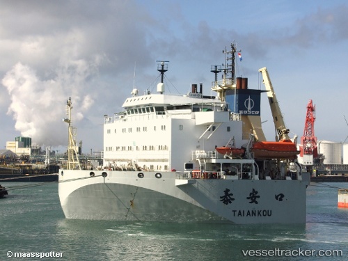
 Tai An Kou
Current Status
Where is the vessel?
Tai An Kou is currently in 10 nm NW of AL HAMRA, based on AIS data received about 3d ago.
Latest AIS update:
Current position: 25.81251° N, 55.64534° E (10 nm NW of AL HAMRA)
Average speed (last 7 days): Loading…
Average speed (last 30 days): Loading…
Vessel profile: Tai An Kou is a Heavy Load Carrier with dimensions 156m x 36m.
This page combines live AIS, route history, probable destination signals, nearby traffic, and port activity for practical vessel monitoring.
The current position of vessel Tai An Kou is 25.81251 lat / 55.64534 lng. Updated: 2026-05-19 15:53:25 UTCNearest reference points:
- 13 nm NW of Hulaylah Terminal
- Near Ras Al Khaimah
- Near Hulaylah Terminal
Currently sailing under the flag of China ![]()
Tai An Kou built in 2002 year
Deadweight:
20247 tDetails:
Live Vessel Tai An Kou Analytics (details, animations, etc.)
Recent AIS points (UTC):
2026-05-19 15:53:25 UTC · 25.81251, 55.64534 · SOG 0 kn · COG -1°2026-05-19 15:53:25 UTC · 25.81251, 55.64534 · SOG 0 kn · COG -1°
2026-05-19 15:53:25 UTC · 25.81251, 55.64534 · SOG 0 kn · COG -1°
2026-05-19 15:53:25 UTC · 25.81251, 55.64534 · SOG 0 kn · COG -1°