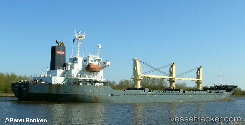
 CECELA S
Current Status
Where is the vessel?
CECELA S is currently in Near Marfleet, based on AIS data received about 14h ago.
Latest AIS update:
Current position: 53.74076° N, 0.26467° W (Near Marfleet)
Average speed (last 7 days): Loading…
Average speed (last 30 days): Loading…
Vessel profile: CECELA S is a Bulk Carrier with dimensions m x m.
This page combines live AIS, route history, probable destination signals, nearby traffic, and port activity for practical vessel monitoring.
The current position of vessel CECELA S is 53.74076 lat / -0.26467 lng. Updated: 2026-05-21 22:19:05 UTCNearest reference points:
- Near Hull
- Near Immingham
- Near Hessle/Hull
Currently sailing under the flag of Liberia ![]()
Details:
Live Vessel CECELA S Analytics (details, animations, etc.)
Recent AIS points (UTC):
2026-05-21 19:49:19 UTC · 53.64634, -0.19214 · SOG 7.2 kn · COG 315°2026-05-21 19:56:40 UTC · 53.65980, -0.20555 · SOG 8 kn · COG 345°
2026-05-21 22:07:10 UTC · 53.74070, -0.26470 · SOG 0.2 kn · COG 107°
2026-05-21 22:19:05 UTC · 53.74076, -0.26467 · SOG 0 kn · COG 107°