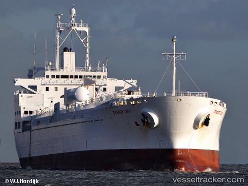
 Orange Sky
Current Status
Where is the vessel?
Orange Sky is currently in 56 nm NE of São Bento do Norte, based on AIS data received about 14h ago.
Latest AIS update:
Current position: 4.58645° S, 35.35280° W (56 nm NE of São Bento do Norte)
Average speed (last 7 days): Loading…
Average speed (last 30 days): Loading…
Vessel profile: Orange Sky is a Fruit Juice Tanker with dimensions 171m x 27m.
This page combines live AIS, route history, probable destination signals, nearby traffic, and port activity for practical vessel monitoring.
The current position of vessel Orange Sky is -4.58645 lat / -35.35280 lng. Updated: 2026-05-22 01:05:04 UTCNearest reference points:
- 20 nm E of Natal
Currently sailing under the flag of Liberia ![]()
Orange Sky built in 2000 year
Deadweight:
26863 tDetails:
Live Vessel Orange Sky Analytics (details, animations, etc.)
Recent AIS points (UTC):
2026-05-21 20:02:59 UTC · -5.65300, -34.78656 · SOG 14.9 kn · COG 348°2026-05-21 21:33:12 UTC · -5.28916, -34.87844 · SOG 14.7 kn · COG 347°
2026-05-21 22:40:15 UTC · -5.02489, -34.95406 · SOG 14.6 kn · COG 350°
2026-05-22 01:05:04 UTC · -4.58645, -35.35280 · SOG 15.6 kn · COG 306°