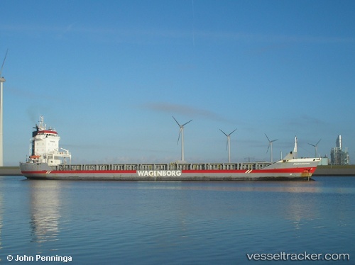
 Missouriborg
Current Status
Where is the vessel?
Missouriborg is currently in 50 nm SW of Castlebay, based on AIS data received about 14h ago.
Latest AIS update:
Current position: 56.30577° N, 8.41922° W (50 nm SW of Castlebay)
Average speed (last 7 days): Loading…
Average speed (last 30 days): Loading…
Vessel profile: Missouriborg is a General Cargo Ship with dimensions 134m x 17m.
This page combines live AIS, route history, probable destination signals, nearby traffic, and port activity for practical vessel monitoring.
The current position of vessel Missouriborg is 56.30577 lat / -8.41922 lng. Updated: 2026-05-21 12:24:34 UTCNearest reference points:
- Near North Harris
- 10 nm NE of Belmullet
- Near GREENORE
Currently sailing under the flag of Netherlands ![]()
Missouriborg built in 2000 year
Deadweight:
9150 tDetails:
Live Vessel Missouriborg Analytics (details, animations, etc.)
Recent AIS points (UTC):
2026-05-21 07:46:21 UTC · 56.88667, -9.51333 · SOG 10 kn · COG -1°2026-05-21 10:07:01 UTC · 56.60388, -8.96277 · SOG 10.6 kn · COG 140°
2026-05-21 11:09:52 UTC · 56.46536, -8.71887 · SOG 11.3 kn · COG 137°
2026-05-21 12:24:34 UTC · 56.30577, -8.41922 · SOG 11 kn · COG 133°