 ODUNE
ODUNE
Current Status
Where is the vessel?
ODUNE is currently in 20 nm SW of Santaella, based on AIS data received about 14h ago.
Latest AIS update:
Current position: 37.35798° N, 4.52592° E (20 nm SW of Santaella)
Average speed (last 7 days): Loading…
Average speed (last 30 days): Loading…
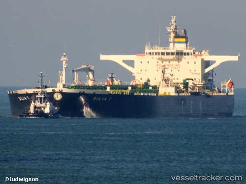
Vessel profile: ODUNE is a Crude Oil Tanker with dimensions m x m.
This page combines live AIS, route history, probable destination signals, nearby traffic, and port activity for practical vessel monitoring.
The current position of vessel ODUNE is 37.35798 lat / 4.52592 lng. Updated: 2026-05-20 23:03:41 UTCNearest reference points:
- Near Zamoranos
- Near Bejaia
- Near Carmona
Currently sailing under the flag of Sierra Leone ![]()
Details:
Live Vessel ODUNE Analytics (details, animations, etc.)
Recent AIS points (UTC):
2026-05-20 17:36:00 UTC · 37.20997, 3.07158 · SOG 12.9 kn · COG 79°2026-05-20 19:01:31 UTC · 37.26475, 3.44367 · SOG 12.7 kn · COG 86°
2026-05-20 22:01:40 UTC · 37.33887, 4.23767 · SOG 13.3 kn · COG 86°
2026-05-20 23:03:41 UTC · 37.35798, 4.52592 · SOG 13.5 kn · COG 87°