 MOONBAY
Current Status
Where is the vessel?
MOONBAY is currently in 58 nm NE of PENGERANG, based on AIS data received about 15h ago.
Latest AIS update:
Current position: 2.02311° N, 104.82756° E (58 nm NE of PENGERANG)
Average speed (last 7 days): Loading…
Average speed (last 30 days): Loading…
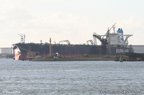
Vessel profile: MOONBAY is a Crude Oil Tanker with dimensions m x m.
This page combines live AIS, route history, probable destination signals, nearby traffic, and port activity for practical vessel monitoring.
The current position of vessel MOONBAY is 2.02311 lat / 104.82756 lng. Updated: 2026-05-19 11:36:13 UTCNearest reference points:
- 55 nm NE of PENGERANG
- 53 nm NE of PENGERANG
- 51 nm NE of PENGERANG
Details:
Live Vessel MOONBAY Analytics (details, animations, etc.)
Recent AIS points (UTC):
2026-05-19 07:33:08 UTC · 2.02406, 104.83015 · SOG 0 kn · COG 325°2026-05-19 10:21:11 UTC · 2.02346, 104.82931 · SOG 0 kn · COG 341°
2026-05-19 11:06:16 UTC · 2.02320, 104.82812 · SOG 0.2 kn · COG 359°
2026-05-19 11:36:13 UTC · 2.02311, 104.82756 · SOG 0 kn · COG 12°